 Hurricane Imelda 2025 (Category 2)
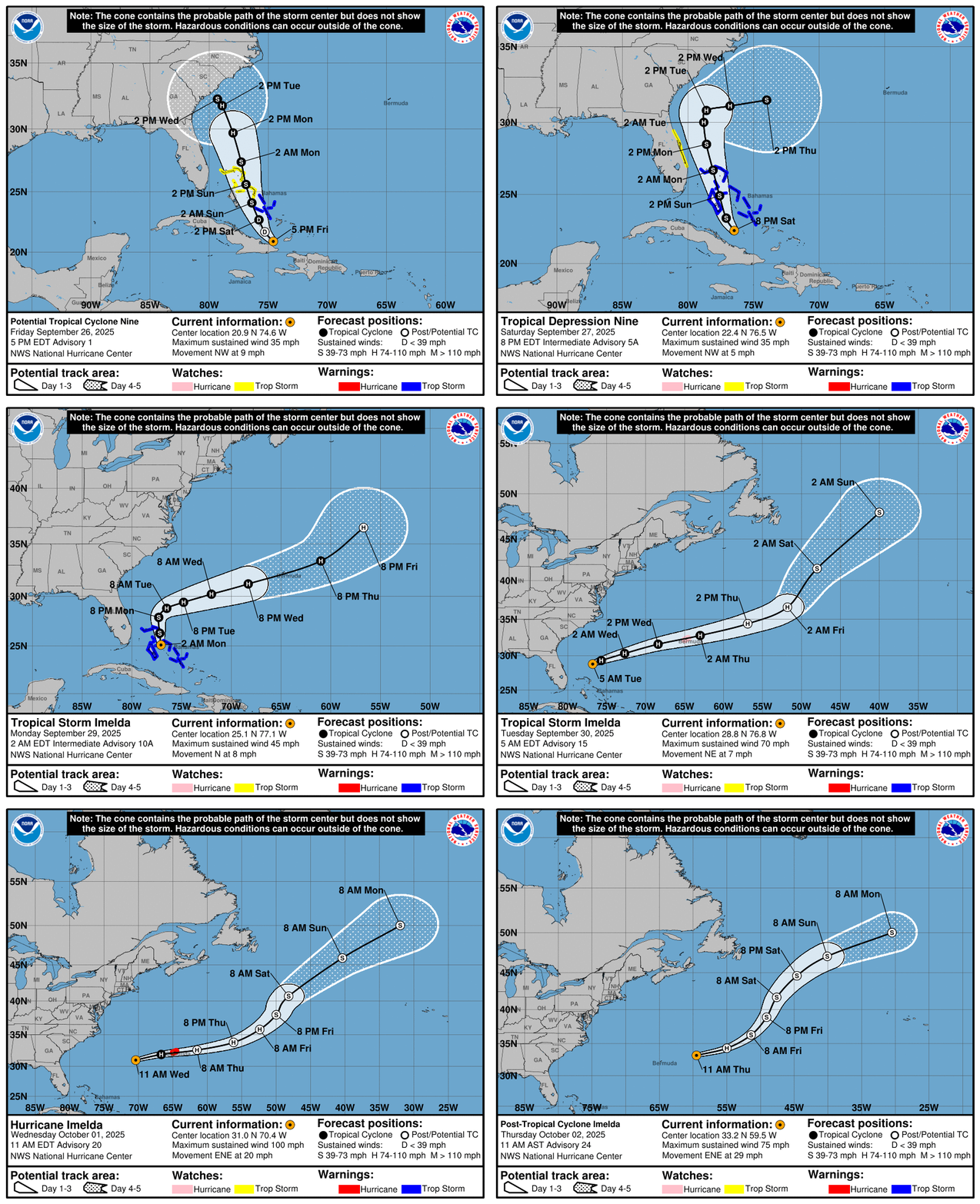
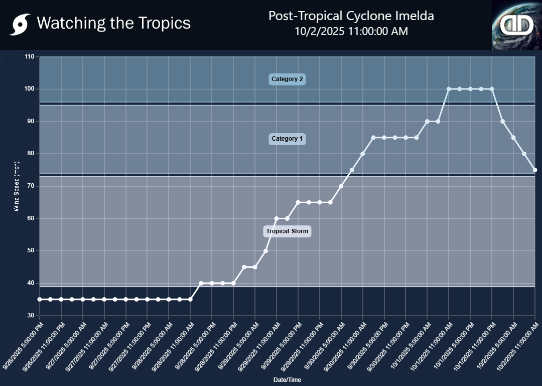
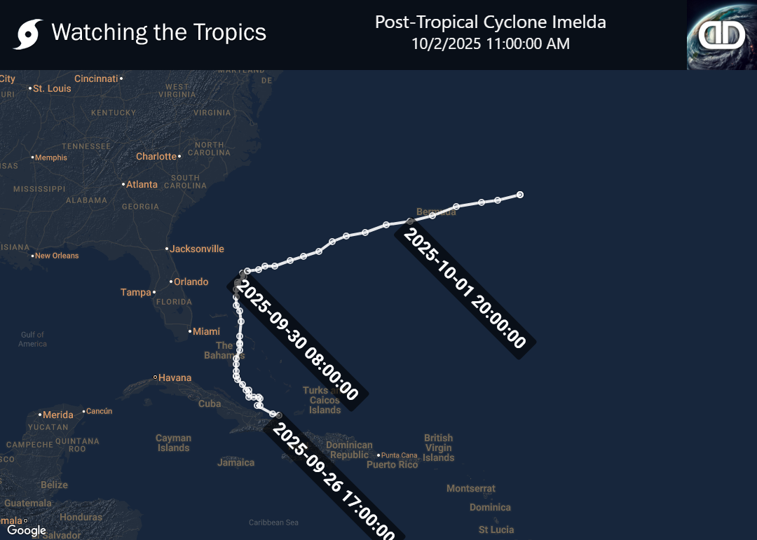
Tropical Storm Imelda originated from a tropical wave that began with disorganized showers and thunderstorms on September 21, far east of the Windward Islands. Over the following days, the disturbance moved westward and gradually started to show signs of organization near Hispaniola by September 25. As the system developed a low-level circulation, it was designated as Potential Tropical Cyclone Nine on September 26. By the morning of September 27, the disturbance further organized and was classified as Tropical Depression Nine. The system progressed to become Tropical Storm Imelda, reaching peak intensity with sustained winds of 40 mph (65 km/h) and a minimum pressure of 998 mbar. Despite its moderate strength, the storm posed significant potential for hazardous weather impacts along its path.
Prior to its official classification, Imelda's precursor disturbance already had significant impacts on the region. On September 23 and 24, it produced squalls and torrential rains across Puerto Rico and the eastern Dominican Republic, resulting in flooding that claimed two lives—one in the Dominican Republic when floodwaters swept a car away, and another in Puerto Rico under similar circumstances. Additionally, areas including Haiti, the Turks and Caicos, and eastern Cuba experienced heavy rains and gusty winds linked to the disturbance. These early impacts underscored the dangers associated with Imelda's weather system, even before it fully developed into a tropical storm. Authorities in affected regions have remained on high alert, monitoring the storm's progression and potential impacts as it continued its path.


