General Information Disclaimer
The information on this website is provided for general informational purposes only. It should not be considered as official guidance or warnings related to hurricanes or tropical storms. Users should always follow the recommendations and orders of official sources such as the National Hurricane Center (NHC), local authorities, and emergency services.
Data Accuracy Disclaimer
While efforts are made to ensure the accuracy and timeliness of the information presented on this site, no guarantee is made that the information is completely current or error-free. Forecasts and models can change rapidly, and users are encouraged to consult multiple sources for the latest updates.
Liability Disclaimer
The operators of this website are not responsible for any damages or losses that may result from the use of the information provided. This site is not liable for any actions taken based on the data, including but not limited to, evacuation decisions or property protection measures.
Third-Party Data Disclaimer
Some data, including maps, models, and forecasts, may be provided by third-party sources such as the National Hurricane Center, weather agencies, or external meteorological services. We do not control or guarantee the accuracy, relevance, timeliness, or completeness of any third-party information.
No Emergency Service Disclaimer
This website is not affiliated with any emergency response or weather forecasting agency. In the event of a storm or emergency, users should contact local authorities or the National Weather Service for official guidance.
Forecasting Uncertainty Disclaimer
Hurricane and tropical storm forecasting is inherently uncertain. Users are advised that conditions may change unexpectedly, and forecasts should not be solely relied upon for decision-making. Always be prepared to act on official alerts.
Usage for Personal Reference Only
The information on this site is intended for personal reference only. It should not be used for commercial purposes or relied upon in place of official storm advisories, evacuation notices, or emergency preparedness measures.
Weather Map & Model Visualization Disclaimer
Weather models, including spaghetti models and forecast cones, are visual representations of potential outcomes. These models do not predict exact impacts, and users should consider the full range of potential weather conditions when preparing for a storm.

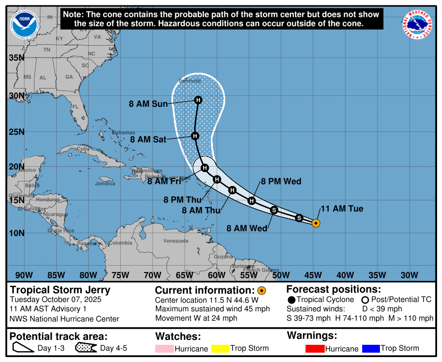
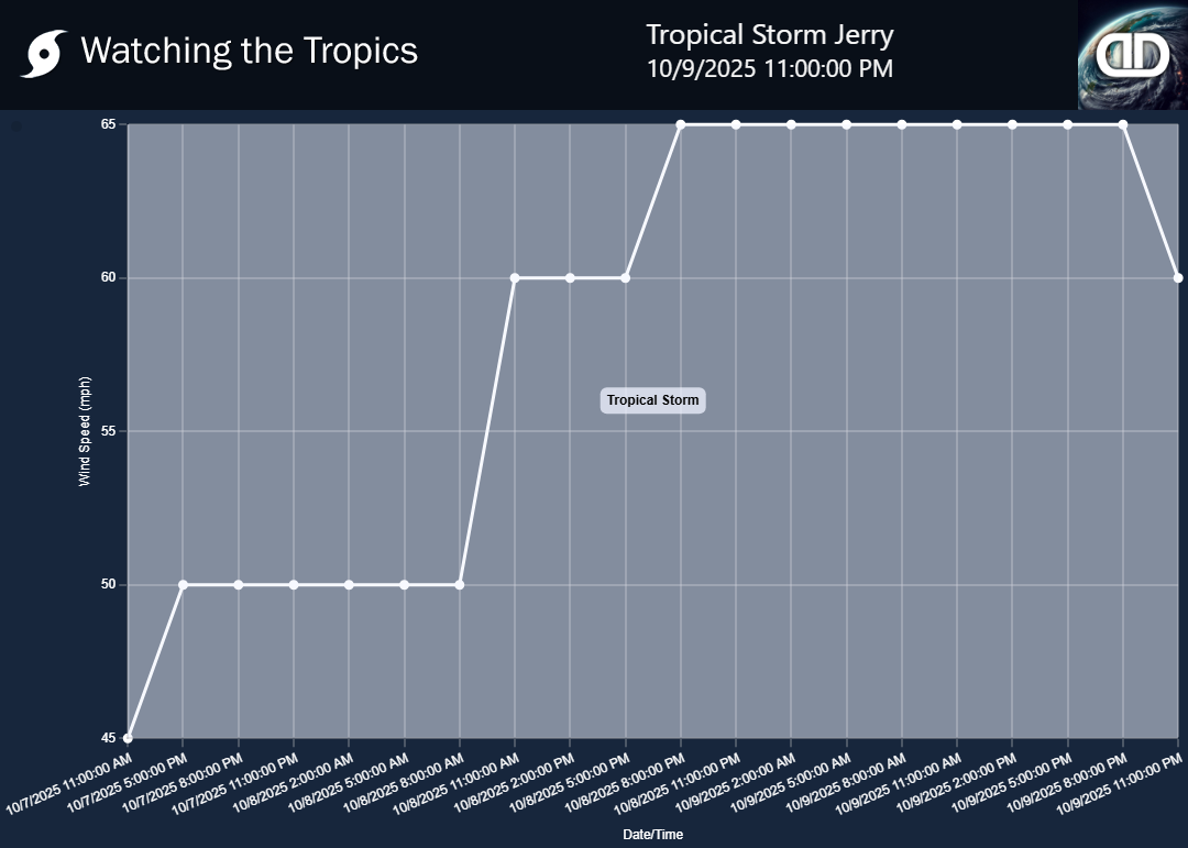
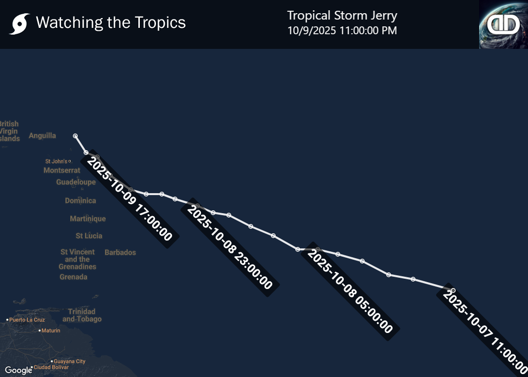
 Tropical Storm Jerry 2025 (Tropical Storm)