 Hurricane Melissa 2025 (Category 5)
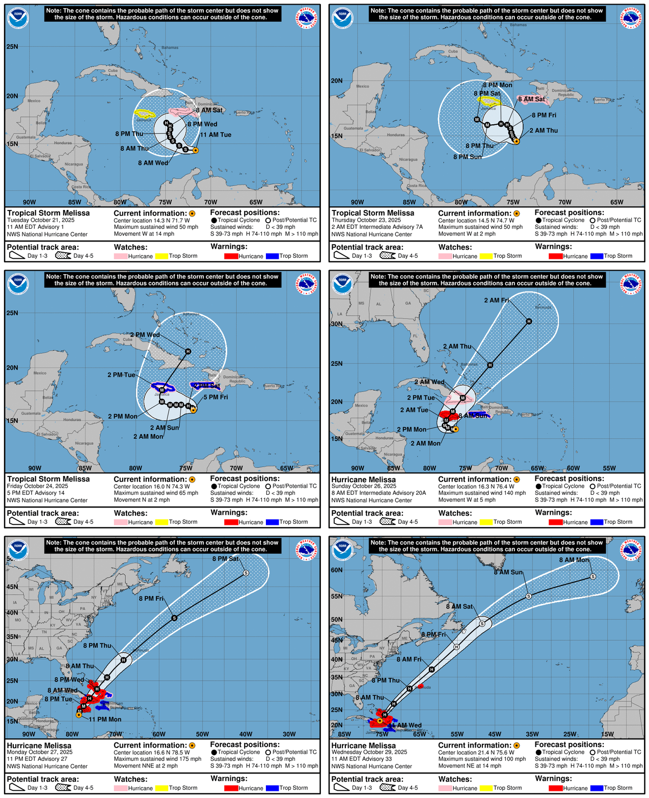
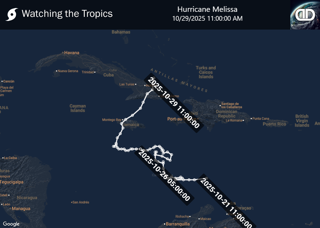
Tropical Storm Melissa originated from a tropical wave that moved off the coast of Africa in mid-October. The National Hurricane Center (NHC) began monitoring this system for potential development by October 16, as it made its way across the Atlantic toward the Caribbean. As Melissa approached the Lesser Antilles on October 18, the system showed increased signs of organization. It developed persistent convection and a well-defined center over the subsequent days. With its forward motion slowing down, the system was officially designated as Tropical Storm Melissa on October 21.
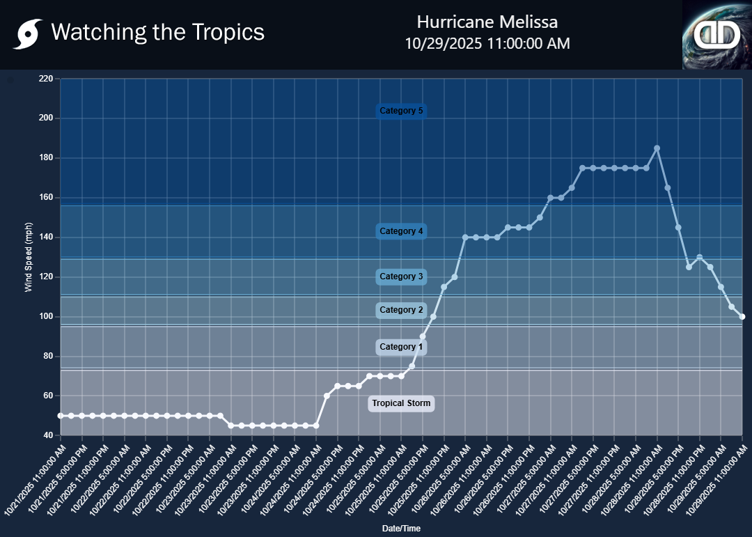
Currently, Tropical Storm Melissa is active and continues to exhibit characteristics typical of a tropical storm. The storm has reached a peak intensity of 50 mph (85 km/h) with a minimum pressure of 1003 mbar (hPa). While the precise trajectory and potential impact areas of Melissa have yet to be fully determined, its ongoing presence necessitates continued monitoring by meteorological agencies to assess any potential threat to land. Residents in the storm's projected path are advised to stay informed with updates from local authorities and the NHC for timely information and safety protocols.


